Visualizing Sea Level Rise in the Bay Area
The latest tool from Climate Central displays just how drastically sea level rise is going to affect cities worldwide.
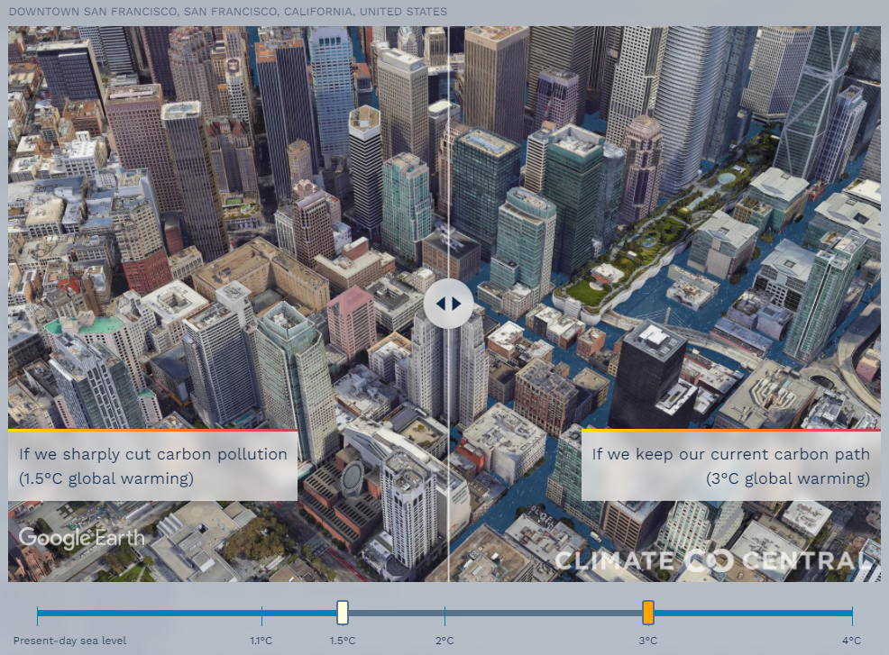
Picturing Our Future provides a prescient vision of the impacts of keeping business-as-usual with our current GHG emissions, as well as scenarios with drastic cutbacks.
An independent consortium of scientists and communicators, Climate Central uses the latest global elevation and population data to create an up-to-date map and visual comparisons of the impact of sea-level rise globally.
Even in scenarios with drastic cutbacks limiting us to 1.5 degrees Celsius of global warming, it is clear that permanent coastal inundation is inevitable, here and in other parts of the world. Which leaves the question-- which future will we choose?
With vulnerable cities and communities in the Bay Area at risk from sea-level rise, it is imperative that we start thinking about how we build resilience in the face of this crisis for a stronger and healthier Bay Area
Learn more about Climate Central.
View this visualizer on their website.